Flat earth geometry compared to actual San Jose CA 400 meter running track

How a flat earth 400 m running track would layout over actual San Jose CA Lynbrook High track

Here are two 400 meter track traces laid out over the Lynbrook High School track in San Jose, CA, one according to spherical earth surface geometry, and the other according to flat circular disk earth geometry, which is shifted slightly to the west (i.e. left) to make it easier to distinguish between the two for comparison purposes.

It is worth pointing out that there are two ways to compare spherical to flat geometry that should be distinguished to avoid confusion. Two blog posts ago where I first introduced walking a track and taking GPS data where I did this at Prospect High School, I showed how the actual GPS trace coincided accurately with the real map of the track and I will further note here that 5.58 km/12 = 465 m/lap is reasonably close to what would be expected for the 8th lane based on a quick web search for that information which gave 454 m/lap. And if you keep the trace the same but instead calculate how far that trace would have gone on a flat earth interpretation, you get almost 10% higher 6.01 km/12 = 501 m/lap. So to emphasize, this is keeping the trace the same and calculating the higher distance you would get with the flat earth geometry interpretation.

Instead in what I am illustrating in this blog post I am figuring out what the trace would need to be according to flat earth geometry in order to give the same distance as the actual track (spherical earth interpretation which is 400 m for lane 1). This is the reason why in this case, the flat earth trace shows up as smaller compared to the actual trace. So here we keep the distance travelled the same and get different traces for flat versus spherical, whereas in the previous case cited of 2 blog posts back of Prospect High School, the traces are kept the same so you then get different distances for flat versus spherical.

The Excel file with these traces is documented here.

SimSphFltLynbrookTrackLapVis      Excel file

SimSphFltLynbrookTrackLapVis      Excel file

This illustrates how the distortion between flat and spherical geometry although not nearly as extreme as that shown in the previous blog post for Santiago Chile, is nevertheless significant and obvious to the eye here at the northern latitude of San Jose, CA.

How 3 flat earth 400 m running tracks would layout over actual Santiago Chile Escuela PDI track

These are actual traces of what properly proportioned 400 m tracks laid out in Santiago Chile according to flat earth circular disk geometry would look like compared to an actual existing properly proportioned track there at Escuela PDI.

Three flat earth geometry tracings of properly proportioned 400 meter tracks overlaying actual 400 meter track in Santiago Chile, one tracing with long dimension running north south and two with long dimension running east west. The flat earth trace with the long dimension running north south exhibits the proportion similar to that of a cigar, whereas the two flat earth traces with long dimensions running east west exhibit the proportions of a pill box.

The Excel file with these traces is documented here.

ChileLeftRightShaftV2Vis      Excel file

ChileLeftRightShaftV2Vis      Excel file

This graphically illustrates the gross distortions in dimensions that occur in the southern lands when comparing imaginary flat earth geometry to real spherical earth geometry.

Running Tracks Worldwide Affirm Spherical Earth

Spherical Earth Affirming One Running Track At A Time

GPS+RunningTrack=FlatEarthDebunked

INTRODUCTION

In my previous blog post I mentioned looking at shorter trips and even walking routes that might give ample evidence to clearly affirm the spherical earth and debunk the flat earth.

And as I have tried a few different things, I have come upon a concept that will truly bring spherical earth affirming and flat earth debunking to the masses all over the world.

It turns out that no matter where you go throughout the world, wherever there is civilization, there are sports fields and running tracks, the tracks being nominally 400 meters around for one lap. It is true that there have been some different standards throughout the years, so tracks of differing dimensions will certainly be found. But anyone could easily measure for themselves the dimensions of their track for further verification if desired.

So no matter where most people live, they are most likely going to be able to find a nearby school with a track where they can go and do some walking (or running) around the track and do experiments with their GPS’s.

I have already done three different tracks at schools close to where I live. I will share the details of the one I just did yesterday.

PROSPECT HIGH TRACK WALK

I walked 12 laps in 1 hour 8 minutes 43 seconds. I stayed in the outermost lane the whole time, which in this case happened to be lane 8. I noted exactly where I started and after each lap would pause at that point for a few seconds just to mark that in the GPS data trace. As before, I used the tracking feature in GPS Essentials on my smartphone.

Once you finish the walk, you stop the tracking and then export the KML file. I then go to the website GPSVisualizer.com where I can upload the file and manipulate it in various ways, as I have explained in detail in previous posts. If you wish you can immediately have GPSVisualizer display the trace on a google map. I also convert it to a text file so I can import it into Excel where I do other calculations of my own, which again I have covered in detail in previous posts.

The beauty of using these running tracks is that they are pretty much standard throughout the world and wherever they are you can find them on google maps and verify that the traces of these tracks in terms of latitude and longitude make sense according to spherical earth surface geometry, but show major inconsistencies when trying to explain them according to flat earth circular disk surface geometry.

The inconsistencies become greater and greater the further south you go, so that in South America or Australia the inconsistencies are truly gross. Do you suppose that there may be some Olympic records that need to be adjusted according to flat earth theory? This is truly an important question to ponder. This is not unlike in an earlier blog post where I pointed out that the around the world flight non-stop without refueling was much more impressive and a greater world record according to flat earth theory.

So for my trip around the track 12 times I travelled 5.58 km at an average speed of 4.88 km/hr and these checked out with my own independent calculations in the Excel spreadsheet. For the flat earth surface geometry, the Excel spreadsheet showed that I travelled 6.01 km at an average speed of 5.25 km/hr in flat earth fiction land. The Excel spreadsheet also showed that the fictitious flat speed increased in a regular pulsating manner throughout the walk according to the regular changes in heading that going around a regular shaped track naturally produces.

As before I am sharing all my files through my Scribd account. You would at least need to register for a free Scribd account to be able to download the files, I believe.

20171210182010-38065-data      text file

text file

558488ProspectTrack8thLane      Excel file

Data in Excel file

558488ProspectTrack8thLaneSphFlt     Excel file

Spherical & Flat cases processed in one Excel file

I have also set up a special email address where anybody can email me GPS data files that they might like me to process for them. I have no idea how many might send me such files, so I cannot make any promises about processing all of them. Certainly those with some written explanation of what is included would rate higher in priority to process.

SphereAffirmer@att.net

WILL FLAT EARTH ADVOCATES INDEFINITELY CLAIM THEY HAVE NO FLAT EARTH MAP?

We simply cannot let the flat earth advocates continue to use their ruse of claiming they have no flat earth map to continue evading the clear deviations from reality of their theory. The problem is that different aspects of their theory together lead to conflicting conclusions. I covered this in a satirical manner in my earlier blog post on Tri-Location on the Flat Earth.

So let me just state the simplest part of their theory that should clearly establish a correspondence between coordinates on the spherical earth map versus their claimed flat earth map. Since they show the Sun completing a cycle in 1 day or 24 hours, the Sun would have to traverse 360 degrees of longitude in 24 hours. This would be the same whether you have a spherical earth or a flat circular disk shaped earth. So if you know the longitude of a city on the spherical earth its longitude should be exactly the same on the flat earth map. Similar arguments can be made that latitude should also be equivalent if the equator and tropics of Capricorn and Cancer are interpreted equivalently between spherical and flat models, as surely they must be or the flat earth theory makes absolutely no sense at all.

So if you were to go to a southern hemisphere place in Chile or Australia and layout a running track according to flat earth geometry of latitude and longitude its shape will be grossly different than the actual running track laid out according to real measurements and also in precise agreement with spherical earth surface geometry of latitude and longitude. I plan to show this graphically in a future post.


Flat Earth If It Doesn’t Fit It Must Be Shlt

INTRODUCTION

This presents more data and its processing and analysis just like the previous blog post. All the explanatory details do not need to be repeated here. If you need to, refer back to the previous post. As before, all files are shared freely on my Scribd account, so people can see and check and analyze my work, and use these files to do their own experiments for themselves no matter where they are in the world.

For review I just want to summarize the basic concept upon which these types of experiments are based.

You travel a route and track it with GPS and independent odometer and speedometer, and maintain constant speeds as much as you can throughout the trip and note this information also. Afterwards you process the latitude longitude data versus time according to spherical earth surface geometry and flat circular disk earth geometry and compare the results. Invariably what you will find is that the spherical geometry interpretation reconciles all the data with itself. The flat geometry interpretation leads to significant contradictions.

It is really up to flat earth advocates to explain how the data should be interpreted in order to make it conform in all ways to flat earth geometry and theory and at the same time to reality. I claim that to make this fit flat earth theory is an impossibility. The pizza pie is really in their pizza oven now.

Now the way that I am interpreting the data according to flat circular disk earth geometry is to take the latitude longitude data and interpret it with the azimuthal equidistant map as if it were a flat earth map. Now I have tried interpreting it in two other possible ways consistent with different aspects of flat earth theory. Both of these ways also lead to significant contradictions.

One way is shifting all of the latitude data points up by the same amount to bring the west east gradient in terms of miles traveled per degree of longitude the same on flat circular disk earth geometry as it is on the spherical earth where the data was actually taken. This ends up fitting the speedometer and odometer data pretty well, but obviously the location is way off, as it shifts my San Jose data north around 500 miles to approximately Sisters Oregon.

Could flat earth advocates actually have an uncertainty of locating a place on the flat earth map of as much as 500 miles? If their “map” which they claim not to really have yet, has this much uncertainty, then what business do they have using any so called “flat earth map” to justify all of their many claims that the earth is flat, like the way that the Sun and Moon circle around it, and the way that airline flights make more sense (they claim) on the flat earth map than on the spherical earth map?

And then the other way I have tried to make the data fit flat earth circular disk geometry is to essentially flatten the spherical data and then plop it somewhere on the flat earth map. The spherical data itself is close to being flat just by its nature of being a route of not much overall distance on the earth, but mathematically it is kind of like me taking that route that is already pretty close to flat and putting it on an ironing board and ironing it flat so I can then easily plop it onto any flat earth map. Here again, we would need the flat earth advocates to tell us where to plop it. So I choose making the starting point of latitude and longitude the same on the flat as on the spherical. When I do this, there is quite a bit of agreement, but the route ends up not coinciding with the actual route of the trip. Again, it just does not fit. At this point I am holding off on presenting this additional information in detail, until I can find a way to present it in as simple and understandable way as possible. Also, I want to give flat earth advocates a chance to struggle with trying to make their flat earth model fit the real world data.

How long can flat earth advocates keep hiding underneath their undefined flat earth map?

Eventually many will have no choice but to exclaim, “Look! The Flat Earth Emperor is wearing no map!”

SO NOW ON TO PRESENTING THE NEW DATA

Here I want to illustrate how a shorter trip can provide good data for this type of experiment and analysis. After this perhaps I will try an even shorter trip by car around just residential streets. If that ends up working OK, then the next step might be to see if the experiment can be done by walking a route around the neighborhood.

The same file naming scheme as before is still used. The previous blog explained the rationale behind this. In this case in the Excel files the data extends down to row 1642.

For this trip I was able to hold a constant speed with cruise control for almost the entire distance on the freeway. There was really just one place where I had to slow down briefly for some night time construction work. As before, the constant speed held shows up very clearly in the data processed according to spherical earth geometry, whereas when the data is processed according to flat earth geometry the long intervals of constant speed deviate markedly from being constant. Here’s the results.

Freeway Circle Around Home in San Jose

35.2 km (21.9 miles) by odometer

Duration by watch 0:32

Duration Start to Stop GPS 0:32:20

35.1 km 65.1 km/h ave speed 97.2 km/h top speed by GPS

35.054 km 65.015 km/h ave speed confirmed by calculations in Sph Excel spreadsheet

Speed versus Time plot for spherical model shows clear agreement with speedometer data

Speed versus Time plot for flat model shows large deviations from speedometer data

38.2 km 70.9 km/h ave speed by calculations in Flt Excel spreadsheet Inconsistent with odometer data

Spherical Earth model: Affirmed

Flat Earth model: Large deviations from reality

Speed versus Time according to Flat theory

Speed versus Time according to Flat theory

Speed versus Time according to Spherical theory

Speed versus Time according to Spherical theory

Speed versus Time according to Spherical and Flat theory all on the same graph.

Speed versus Time according to Spherical and Flat theory all on the same graph

I have made these files available to the public through my Scribd account.

20171130214830-38065-data    Text file

20171130214830-38065-data     Text file

351651FreewayCircleAroundHome           Excel file

351651FreewayCircleAroundHome           Excel file

351651FreewayCircleAroundHomeFlt        Excel file

351651FreewayCircleAroundHomeFlt        Excel file

351651FreewayCircleAroundHomeSph       Excel file

351651FreewayCircleAroundHomeSph       Excel file

Anybody should be able to see the files by just going to the links. The graphs of Speed versus Time for both the spherical and flat cases should be able to be seen this way in addition to the links earlier in this post. To download the files you need a Scribd account, and a regular account should be free to set up.

I was not able to make the KML file Track-171130-210519 available through Scribd because it is not a supported file type.

I encourage people all over the world to take their own data and process it in this manner and report their results. Let me know if you have any questions. Comments are welcome. Thank you.


GPS + Odometer + Speedometer + Cruise Control = Spherical Earth Affirmed (San Jose to Berkeley)

GPS+Odometer+Speedometer+CruiseControl=SphericalEarthAffirmed(SanJoseToBerkeley)

INTRODUCTION

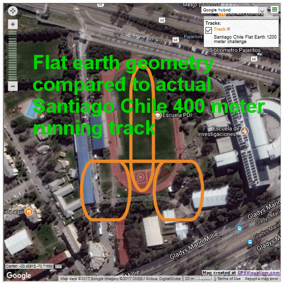
I recently got a very helpful suggestion from a person in Santiago, Chile, that expressing my work in metric units would be helpful to the international community, so this motivated me to travel metrically on a trip yesterday, as much as I was able, and to report the experimental results metrically as well.

In a nutshell, you track a car trip with your GPS and use cruise control to maintain intervals of constant speed as much as you can during the trip, noting the constant speeds you maintained as well as where on the trip you were able to do so. Once you get the GPS data you can analyze it and show that a spherical earth surface geometry interpretation of the data accurately gives the regions of constant speed and the overall trip distance in agreement with the car’s odometer and speedometer. On the other hand when you interpret the data according to flat circular disk geometry the intervals of constant speed do not show up as constant at all and the overall trip distance is much in error from the distance measured by the car’s odometer. I can already hear flat earth advocates saying something like the GPS data comes out right because it is based on spherical geometry, and indeed I agree that it is so based, but the car’s odometer and speedometer are independent of what theory of the earth’s surface you hold. The car should give accurate speeds and distances traveled whether you are on a flat earth or a spherical earth, or any other shape for that matter. The fact that the GPS data agrees with the independent data from the car’s odometer and speedometer is strong evidence that the spherical earth model is correct. The fact that the GPS data when interpreted according to flat circular disk geometry disagrees profoundly with the independent data from the car’s odometer and speedometer is strong evidence that the flat earth model is incorrect. I challenge all flat earth advocates and researchers to find a way to interpret the trip GPS data so as to show that it conforms to flat earth theory and also agrees with the independent data of the car’s odometer and speedometer.

The beauty of this experiment is that whenever someone does it they are going to get unique results that cannot possibly be predicted or planned for in advance. Where and at what speeds you are able to hold steady speeds with cruise control will vary with the road and traffic conditions. The path of the trip used will also impact the results in a unique way.

This type of experiment can easily be performed for a vast variety of trips all over the world and the data easily analyzed. I am going to share exactly how this can be done by showing how I did it for a trip from San Jose to Berkeley CA yesterday. All details are presented and the Excel files are made available to anyone through my Scribd account so they can see how it was done and use the spreadsheets to process the data from their own trips as well.

DETAILS FOR TRIP FROM SAN JOSE TO BERKELEY

I used the GPS in my smartphone, a Samsung Galaxy S4. I used the App GPS Essentials, where at the start of your trip you start tracking, and when you arrive at your destination you stop tracking. The trip file can then be exported as a KML file. From there you can process the data in various ways. I like to use the website GPSVisualizer.com for some things and Excel spreadsheet for many other things.

Car speedometer and odometer

It was easy to push a button to get my speedometer to read in km/h instead of mph, so that way I could easily see what my speed was in km/h during the trip. I was not sure how or if I could get the odometer to read in km, so I took the readings in miles and converted to km.

Trip from San Jose to Berkeley

91.1 km (56.6 miles) by odometer

Duration by my watch 1:10

Duration Start to Stop GPS 1:09:28

90.6 km 78.3 km/h ave speed 131 km/h top speed reported directly by GPS

From my smartphone I exported the trip KML file via email to my PC. The KML filename was Track-171126-105544. I then went to the website GPSVisualizer.com, where I uploaded the KML file and choose output format plain text table. I then clicked the link to download this text file back to my PC. I accepted the default filename 20171126171339-38065-data. I then opened the Excel spreadsheet application. My version happens to be from 2010. From within the Excel application, find the text file and open it. Either select to look at All Files or just Text Files to make sure you can see the correct text file to open. Once you open it, the Text Import Wizard comes up. The default settings are fine, so just click on Next, Next, and then Finish. At this point I like to do a Save As on the file, and save it as an Excel Workbook file, and give it a name that is more meaningful to me. So I gave it the name 906783SanJoseToBerkeley. I got the 906 from 90.6 km for the trip and 783 from 78.3 ave speed for the trip in km/h and added SanJoseToBerkeley to further help me identify this data. I will use this name with additional things added to it as more files are produced based on processing this data. I do not intend to make any further modifications to the Excel Workbook file 906783SanJoseToBerkeley so this can be kept as a record of this stage of the data processing procedure that could easily be returned to as needed. So then I will again do a Save As to the file and give it the name 906783SanJoseToBerkeleySph. This will be the file where some modifications will be made so it will do calculations according to spherical earth geometry. One other change I like to make at this point is to rename the data tab. So go to the lower left and right click on the data tab, that currently has the really long name that came from the GPSVisualizer when it created the text file from the KML file, and select rename. I like to rename it 906783-data. Once you do this be sure to save the file again. And then do another Save As and save it with the name 906783SanJoseToBerkeleyFlt. This will be the file where some modifications will be made so it will do calculations according to flat circular disk shaped earth geometry.

So let’s start by working on the 906783SanJoseToBerkeleyFlt file. If you have followed the directions exactly as above that file should already be open. If not, open it now. Also open the Excel file FltGeomMetricUnitsTemplate. This is the file where we are going to copy the section with the equations for calculation and paste them into file 906783SanJoseToBerkeleyFlt.

In the 906783SanJoseToBerkeleyFlt file select across from Column E to Column J, so that Columns E, F, G, H, I, and J are all selected. Be sure to select across the column headings so that the entire columns will end up being selected. Then Right-Click anywhere inside the selection and choose Insert. This then creates 6 empty columns from E to J, and moves the other stuff to the right so nothing is lost. In these 6 columns is where we are going to do some calculations on the data. So we are now going to get the equations from the FltGeomMetricUnitsTemplate file and copy and then paste into the new spreadsheet. So from FltGeomMetricUnitsTemplate select from E1 upper left to J12 lower right so that a rectangle of 12 cells down and 6 cells across are selected. Then Copy (Ctrl-C). Then go to the 906783SanJoseToBerkeleyFlt spreadsheet file and select cell E1 to define the upper left of where to Paste. Then Paste (Ctrl-V). At this point the equations need to be filled down to the extent of the data. Select cell E12 which defines the upper left. Scroll down to the very bottom of the data, in this case row 3416. Shift-Click on cell J3416. This will result in all cells bounded by E12 on the upper left to J3416 on the lower right to be selected. Then do a Fill Down (Ctrl-D). This then results in the equations being pasted all the way down so we get the calculations done that we wanted for the entire extent of the data. Two values can be read off of the spreadsheet at this point. If you go to cell G3416 the total distance of the trip according to flat earth interpretation is 96.2 km and to cell I3416 the average speed is 83.1 km/h also according to flat earth theory. Next we will create a plot of speed versus time. Column J is speed smoothed over several data points and is what I will use because it minimizes the natural scatter in the data for a better looking plot. If you want to use the point to point speed just use column H for speed instead. So select from cell B12 to B3416. The way I like to do this is first select cell B12, then scroll all the way down and shift-click on cell B3416. Next we want to add to the selection cells J12 to J3416. The way I like to do this is first Ctrl-click on cell J12 and then scroll down and shift-click on cell J3416. Now that we have selected two separate columns, one defined by cells B12 to B3416, and the other defined by cells J12 to J3416, we can create a plot of this speed versus time data. So go to Insert, select Scatter, and then Scatter with straight lines is the one I like. This puts the plot in front of the spreadsheet table. I like to make it separate with its own tab. So right click in the right area of the plot and chose Move. Then click the button and accept the default name of Chart1 or give it your own name. I like to call it SpeedVsTimeSm, for speed versus time smoothed. This then is the speed versus time plot based on the flat earth interpretation of the data. This will eventually be compared with the equivalent plot based on the spherical earth interpretation of the data. What we will find is that the intervals where the speed was held constant with cruise control show up clearly and distinctly constant on the spherical earth interpretation, but with much variability on the flat earth interpretation.

So basically to get the equivalent calculations for the spherical earth surface model, repeat everything above, but instead using SphGeomMetricUnitsTemplate and working on file 906783SanJoseToBerkeleySph.

Once you do this you will get the results that I have summarized below.

Trip from San Jose to Berkeley

91.1 km (56.6 miles) by odometer

Duration by watch 1:10

Duration Start to Stop GPS 1:09:28

90.6 km 78.3 km/h ave speed 131 km/h top speed by GPS

90.67 km 78.32 km/h ave speed confirmed by calculations in Sph Excel spreadsheet

Speed versus Time plot for spherical model shows clear agreement with speedometer data

Speed versus Time plot for flat model shows large deviations from speedometer data

96.2 km 83.1 km/h ave speed by calculations in Flt Excel spreadsheet Inconsistent with odometer data

Spherical Earth model: Affirmed

Flat Earth model: Large deviations from reality

If I am able to display the Speed versus Time graphs I will show them here. If not they can be seen at the Scribd links.

Speed versus Time according to Flat theory

Speed versus Time according to Flat theory

Speed versus Time according to Spherical theory

Speed versus Time according to Spherical theory

I have made these files available to the public through my Scribd account.

20171126171339-38065-data    Text file

20171126171339-38065-data    Text file

906783SanJoseToBerkeley           Excel file

906783SanJoseToBerkeley           Excel file

906783SanJoseToBerkeleyFlt        Excel file

906783SanJoseToBerkeleyFlt        Excel file

906783SanJoseToBerkeleySph       Excel file

906783SanJoseToBerkeleySph       Excel file

FltGeomMetricUnitsTemplate         Excel file

FltGeomMetricUnitsTemplate         Excel file

SphGeomMetricUnitsTemplate         Excel file

SphGeomMetricUnitsTemplate        Excel file

Anybody should be able to see the files by just going to the links. The graphs of Speed versus Time for both the spherical and flat cases should be able to be seen this way. To download the files you need a Scribd account, and a regular account should be free to set up.

I was not able to make the KML file Track-171126-105544 available through Scribd because it is not a supported file type.

I encourage people all over the world to take their own data and process it in this manner and report their results. Let me know if you have any questions. Comments are welcome. Thank you.